

Sort By
Categories
Sort By
- Most Recent
- Oldest
Categories
- View All
- Security
- Stories
- WherobotsDB
- Spatial Tech
- New Technology
- Data Lake format
- News
- General
- Cloud Integration
- Apache Sedona
7 Mins Read
24 Jun 2024
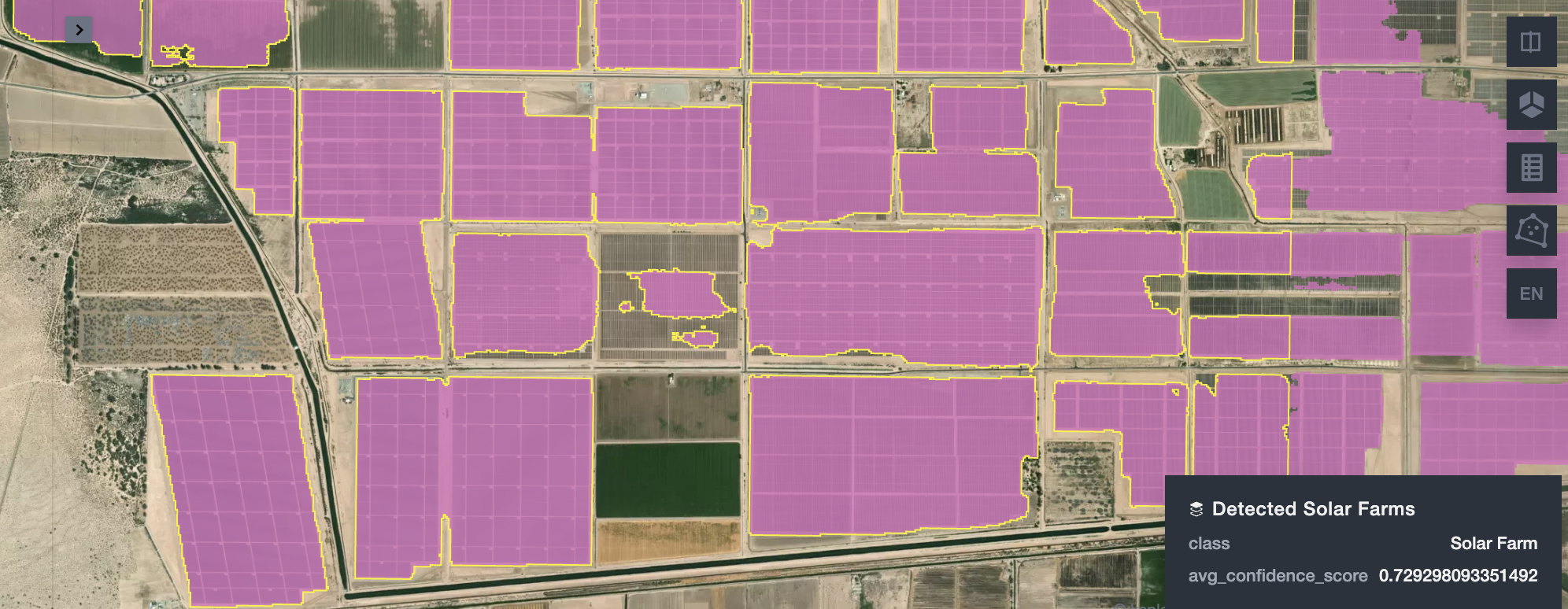
Unlock Satellite Imagery Insights with WherobotsAI Raster Inference
Recently we introduced WherobotsAI Raster Inference to unlock analytics on satellite and aerial imagery using SQL or Python. Raster Inference simplifies extracting insights from satellite and aerial imagery using SQL or Python, and is powered by open-source machine learning models. This feature is currently in preview, and we are expanding it’s capabilities to support more […]


Sign up for our newsletter
Be the first to know about releases and industry news.
We care about your data; read our privacy policy.